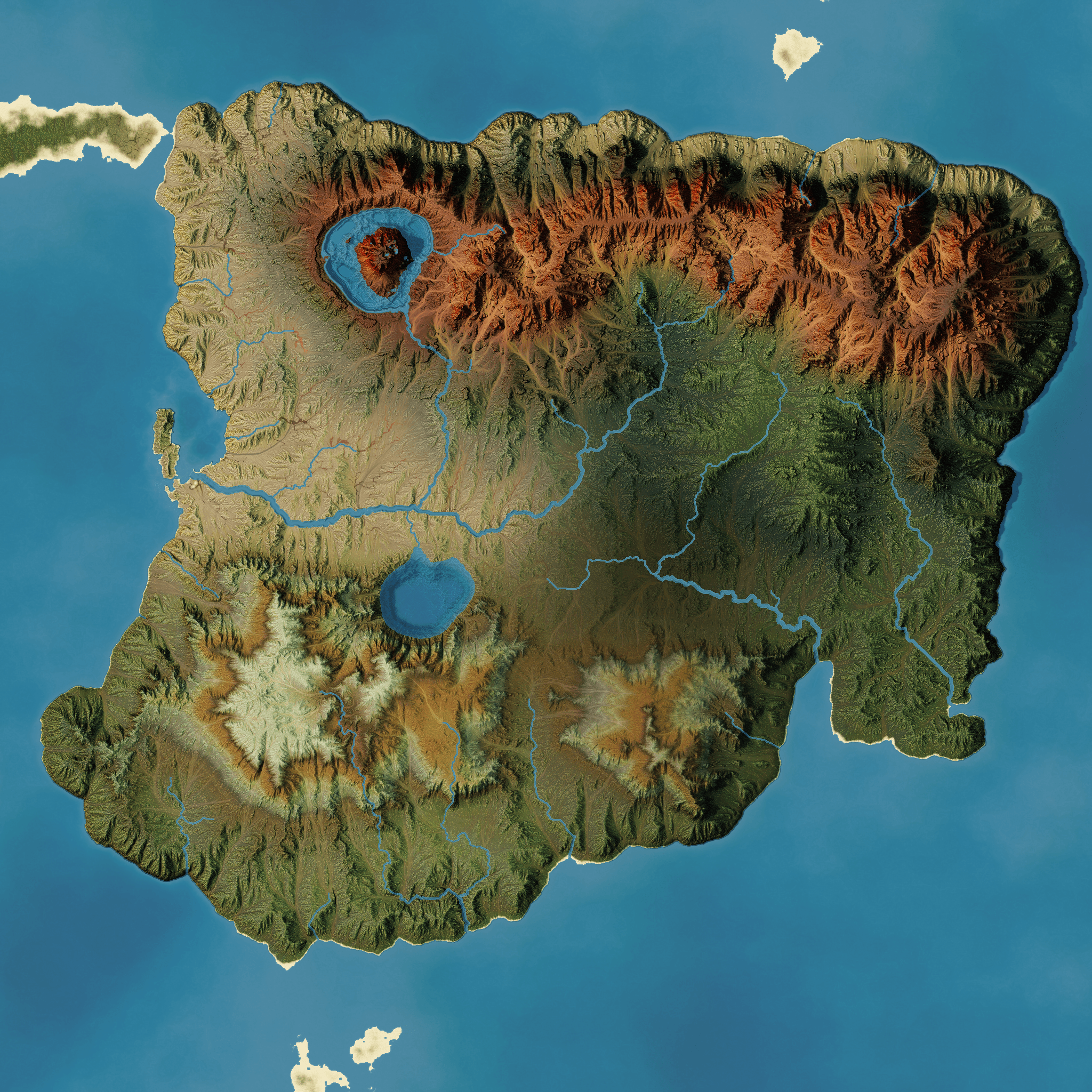
Hey everyone! I took a break from trying to perfect my workflow for canyon terrains to use World Machine to create/finish out a 2D satellite imagery-style map for a Dungeons and Dragons campaign that I run. It was an interesting shift from trying to make a scene that only needed one good angle to make a final image to building out an entire continent that made a modicum of sense geologically, as well as planning out multiple biomes to keep the landscape varied and interesting.
I started out with a simple hand drawn Tolkien-esque map that I’ve been using since the beginning of the campaign, and (through a ton of trial and error) imported the basic landmass into World Machine. From there, it was a long process of trying to get some major land features that I had in the hand drawn map roughly represented in the heightmap, and then weeks of tweaking the textures (that section of the node network is an absolute mess, something like 40 nodes with wires going all over the place). Let me know what you all think!
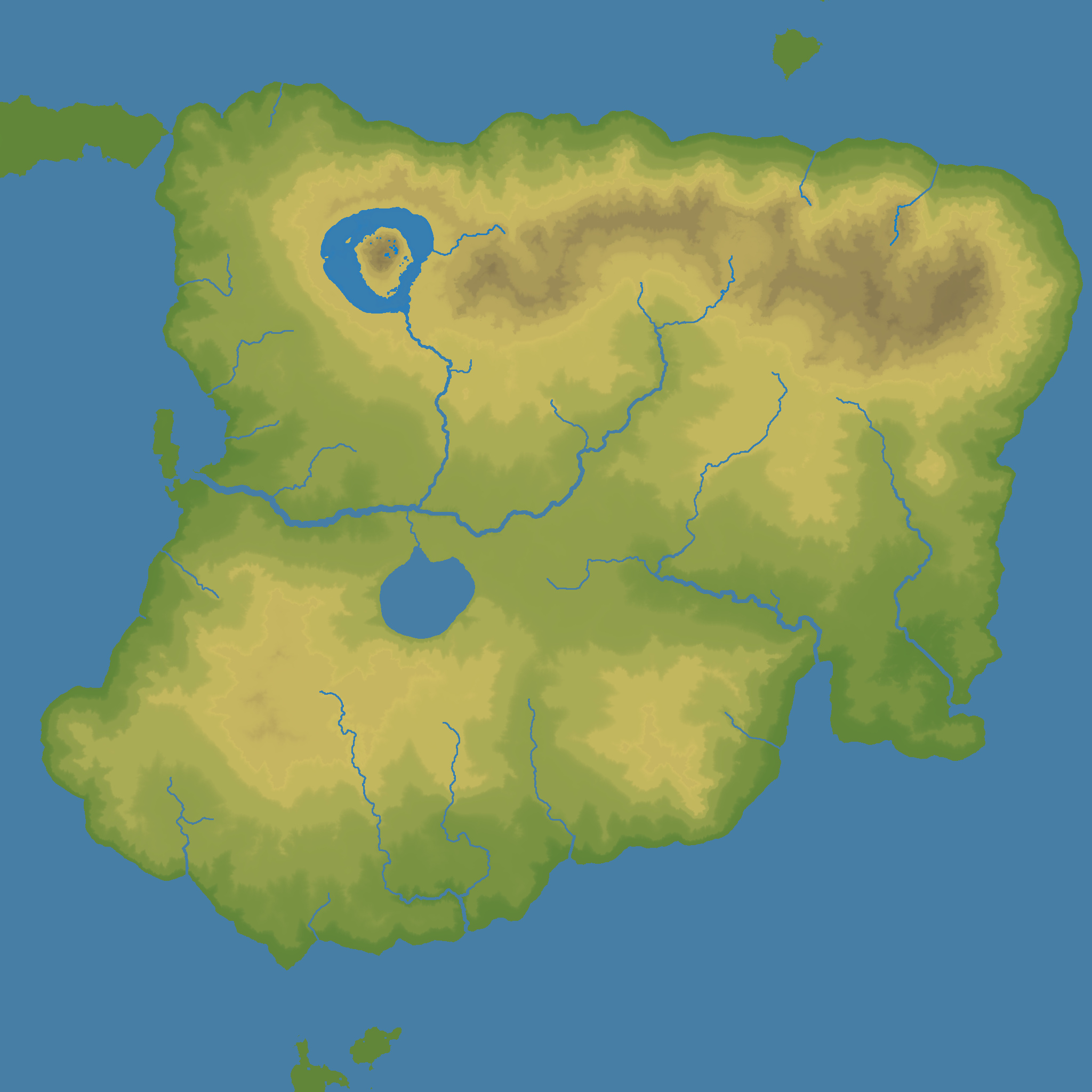
In a bout of “I’ll never finish this, because I want to work on it forever!” I have also made an atlas style map where the colors are simply based on elevation and nothing else, using the best cartographic color mappings I was able to find. I simply set very harsh terraces at a level I felt showed the general nature of the terrain, and made a two gradients (One from green to yellow to brown for the terrain, and one dark blue to light blue for the water, though that one ended up being mostly unnecessary), combining them using a select wetness with precipitation set to a constant of 0 to get just existing water for a mask. Enjoy!
This map will mostly be used when I start to expand the campaign setting into a whole world, rather than the single continent. Eventually, I’d like to have a full world map with latitude and longitude lines and all, and World Machine is going to be a huge part of that project going forward!
As an on-topic aside, I’ve been watching a lot of tutorials on making realistic looking maps for fiction and/or tabletop RPGs, and I’ve only seen World Machine mentioned in passing, usually as a way to generate basic heightmaps to use as bump shading. I’ve been personally finding WM incredibly useful for this use, and am going to start campaigning to see it used more widely in the fantasy mapping world. I may post tutorials on this, if anyone seems interested! Hopefully this can also drive a wider user base to this amazing program!
Good job. Just by looking at it is see countIess hours of iterating. I absolutelly agree with you. I am doing map for game (already for second time) and I have similar issues like you. I need to have 3 clima types and it means, that complexity of such project grows almost exponencialy. It is no problem to generate something random, but once you need specific shape with exactly placed mountains, rivers etc…, it is very, very long and tiring process. Unlike environmental artist you need to have good looking terrain from all angles, not just one.
And biggest time consumer is texturing, it takes hundreds of itereations to get something nice and generate all masks needed for game engine. At the end it is possible, but project has hundreds of nodes and after for example 1/2 year it is not possible to easily do any adjustments, becase you really dont remember how it was done.
Regarding texturing, I liked geoglyph plugin a lot, it saved lots of work, but unfortunatally it does not support latest VMs.
I increased productivity by huge margin by purchasing Ryzen 3950x and 64GB of ram. It allows me to iterate 2-3x faster than before.
Anyway even with these isssues VM is by far best tool for map generation. Other tools look great on the paper (I have all of them), but once you start to prepare something complex, showstoppers appear.
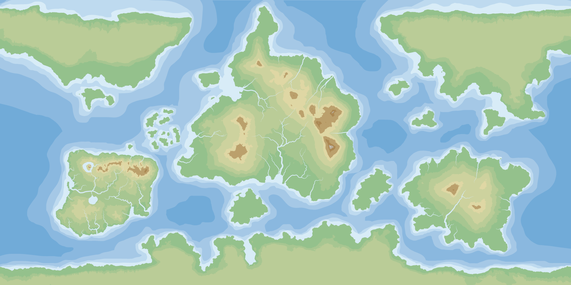
Well, this project has started to become an even larger beast. I’ve extended the map to an entire world map, and, in doing so, have also refined my process for bringing hand drawn maps into World Machine. Ideally, I’m going to start to create extents within the main one to further refine details, working at a higher resolution in each area, but this is where it stands right now. The image you see is coming out of Illustrator at this point, as I’m using that to create a sort of elevation map (loosely following the guide from Artifexian on YouTube), but the bulk of the work was done in World Machine, and I’m mostly using Illustrator to trace out the bitmap from WM into a vector format for easier scaling.