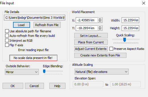
When I import it using File Input, I get an error saying “No scale data present in file!”, resulting in no terrain being generated.
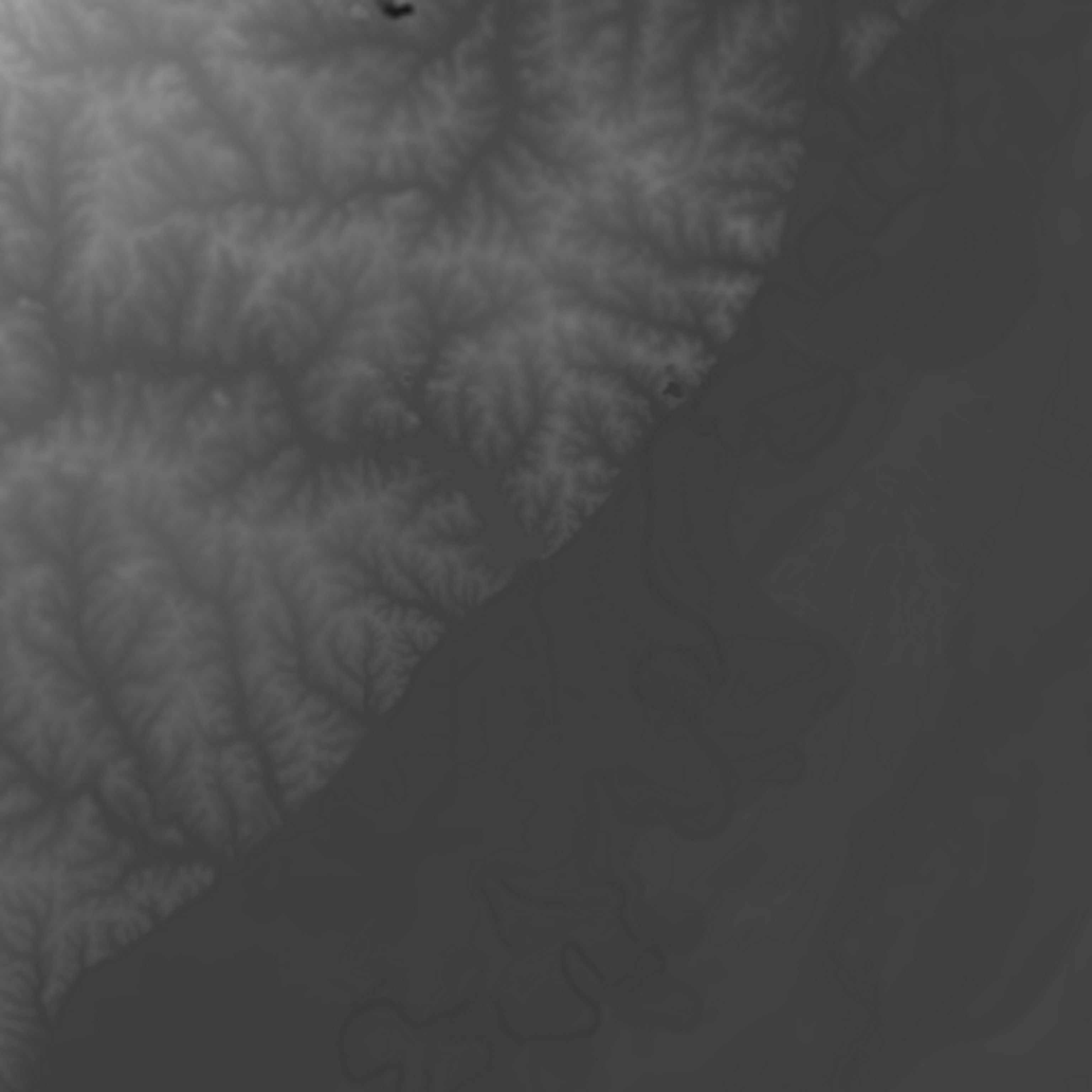
What has me very confused is that a heightmap is a simply grayscale image. It is not supposed to have “scale data” (whatever that means) in it. The File Input window DOES have scale information, so why does it need that same information in the image!?
@bobgrey1997 Something wrong with this heightmap file itself. I just tested another jpeg heightmap, imports fine. Even the resolution isn’t being reported, which makes me think it’s a problem with file’s metadata.
As @WFab says, you really don’t want to use JPG for heightfield data! The lossy compression is almost undetectable when used in a texture or image, but for heightfield data it has all kinds of issues with low bit depth, grid artifacts, fuzzy artifacts, etc. I don’t recommend it at all – but I also realize sometimes you don’t have a choice
I took a look at your file and it appears that it is a single-channel (greyscale) JPG. WM currently only loads RGB(a) jpeg files, which covers most all of the use cases for them due to the above issues. This should probably be fixed, but its a bit low priority.
As a workaround, open your file in photoshop / paint / similar, and re-save as an RGB image. WM will then successfully load it.