Hello,
I’m trying to stitch 2 heightmaps together. A 4096 to the corner of a 8192 hm. I want to keep the elevation range on both default, but the 4096 is required to remain EXACTLY as it is, other than the edges for the heightmatch. The 4096 being 0-200 and the 8192 being 0-1769.09. (actual elevation of either doesn’t matter, only the elevation range. I don’t want it to be skewed at all) It looks like I had it all set up correctly, but when I import it to the game, the elevation range wasn’t exactly correct. I have a feeling it has something to do with the empty extent of the 4096, because if I simply export it by itself before the “chooser”, but still at the 8192 scale the elevation ranges are slightly skewed. If I export it at its original 4096 its fine.
TIA for any suggestions, tips, or walkthroughs.
Ok I better understand exactly what I am trying to do.
I need to blend together 2 heightmaps using the “height-matching blend” chooser device. What kind of setup would I need to keep the smaller HM (input B) unchanged and only modify the larger HM Input A) to height-match the smaller one? A mask that separates them perfectly does combine them like I want, but it modifies both HMs which is not acceptable in my case.
Combination of mismatching terrain data is such a detailed topic in itself. I described different kinds of combination nodes on this forum some time back, I’ll link that post here:
https://forum.world-machine.com/t/work-together-questions/6764/2?u=wfab
In my opinion, you need a “combiner” node for the main combination (max mode full strength, bigger hm in the first input and smaller in the second). Then you need some preprocessing of the heightmaps to match their heights. You can adjust “where” the combination will happen relative to your big terrain in the “layout view” while having your smaller HM selected.
Thank for the reply! I was unable to achieve desirable results for my situation with your method you mentioned. I already have the small HM in place where it should be relative to the large hm. I found I am able to get very close to my desired results using 2 methods. Each with their pros and cons.
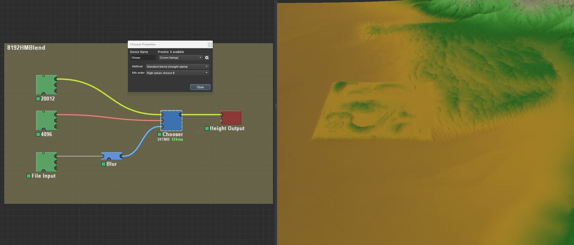
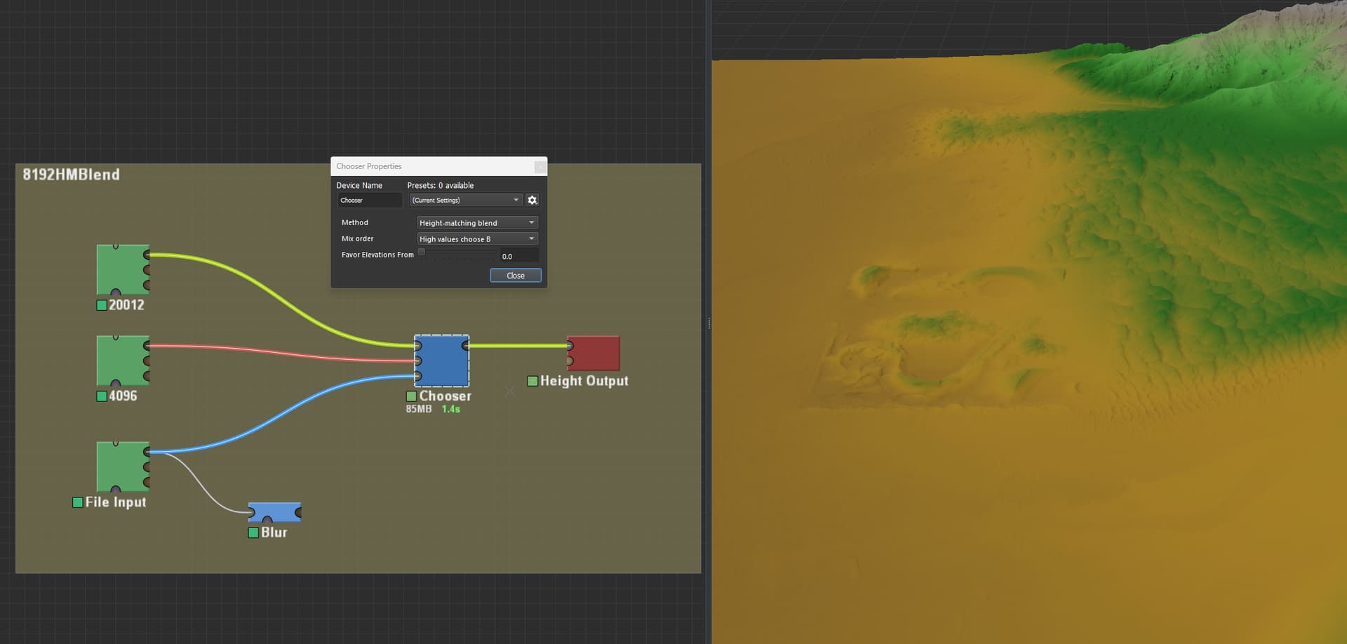
Setup for both methods: My small HM has to use the “Footprint, Outside Area” as “use edge values.” I use the “chooser” node with the large hm as the first input, small hm as the second input. The mask I use separates the 2 hms exactly, white always being being for input B. Both terrains elevation ranged are set to where they should be.
Method 1: This “chooser” node method is “standard blend” “high values choose B” and I use a “blur” node on the mask set to 50m in my case.
This method is good because it keeps both hms exactly as is, and blends the 2 maps, the blend is ok, but not super natural looking.
Method 2: This "chooser node method is “height-matching blend” “high values choose B”. No need to blur.
This method blends the 2 terrains perfectly and makes it look very natural, the problem here is that it warps my smaller terrain.
In my situation, I need the smaller terrain to remain exact, while the larger terrain can warp to the smaller one, essentially combining parts from each method. I feel like I am so close, but am unable to finish. Worst case I will use method 1 as it suites my needs best. I got World machine a couple days ago, so my knowledge is limited.
Thank you for your time,
OTB