Disclaimer:
I know this is quite an old problem but I think it is still a big problem especially when creating islands. I am using Mt. Rainier Build 4020
What is the problem?
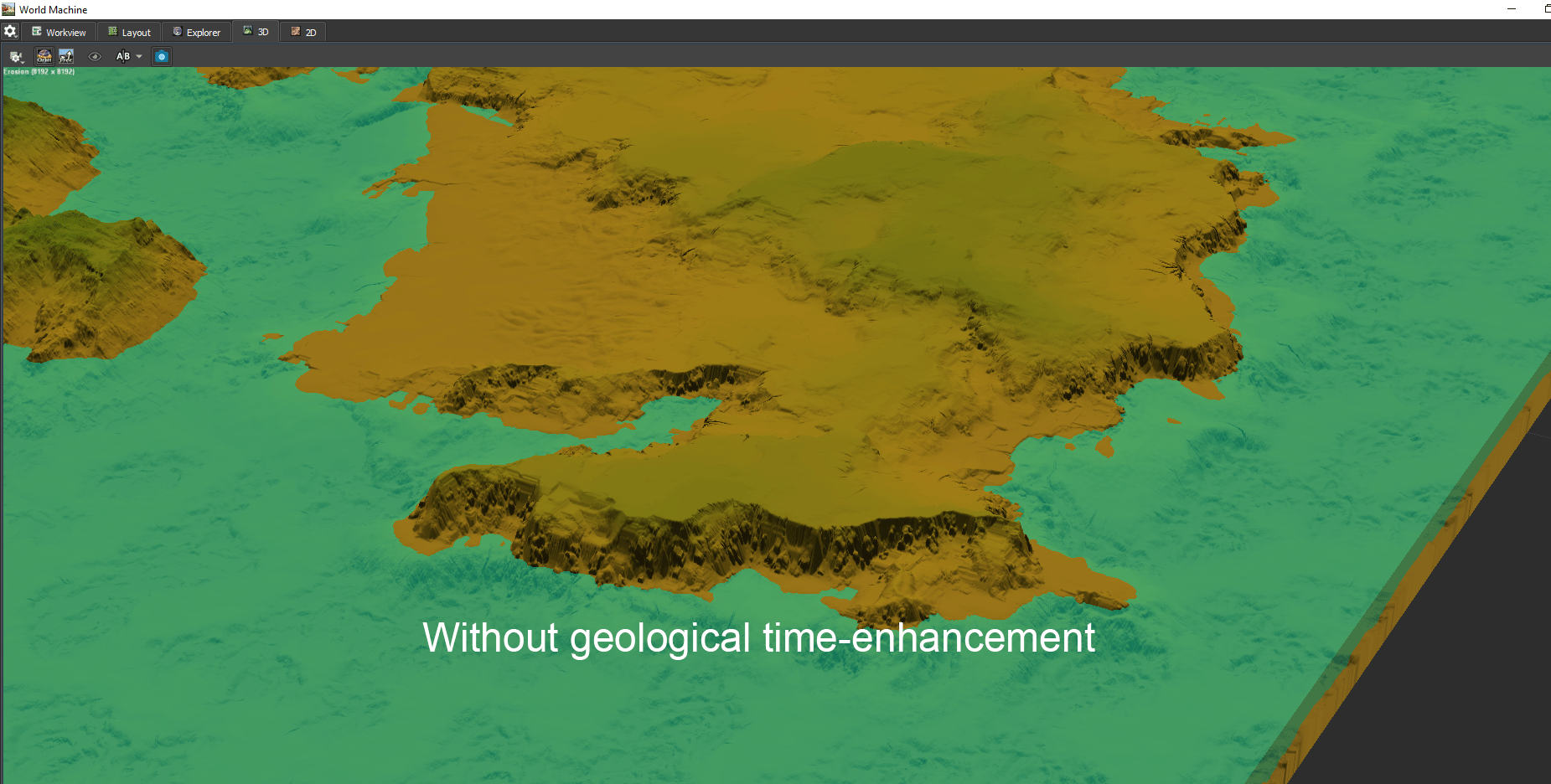
When using the geological time-enhancement feature on erosions some weird stuff happens at extent edges. As far as I can tell terrain is somehow being lifted up and creates unwanted results.
How to reproduce?
Create a new file and add some landmass via an advanced perlin, voronoi or the likes. You can also try creating an island, I mostly use a layout node for that. Once the landmass is done add an erosion. Now observe how the final result changes when using the erosion with and without geological time-enhancement.
Imo this is a big problem because the Geological-time enhancement has a very nice effect on the terrain but it becomes unpredicatble at extent edges and hard to predict what the tiled build result might look like.
Is there possibly any way to mitigate this problem and can we hope for a fix in the future? Frankly I am astouned this bug has persisted so long, maybe it is not easy to fix?
Thanks!
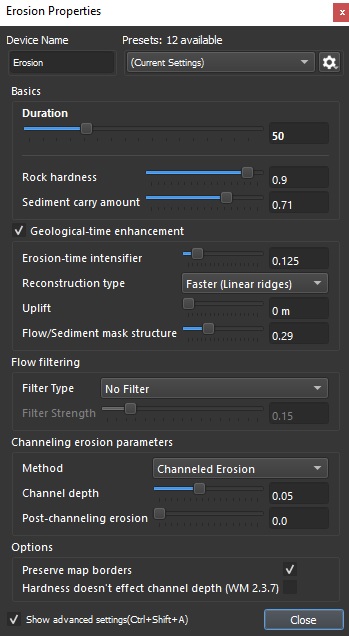
Have you (in the Advanced Settings of the Erosion device) tried enabling the “Preserve Map Borders” option? If that isn’t the solution you are looking for, is there any more detail that you can provide?
Hi, thanks for taking the time!
Unfortunately “Preserve map border” doesn’t seem to make any difference in this case. Not sure what other details I can provide apart from what I wrote. Maybe the erosion settings?
I’m not sure if I’m misunderstanding your issue here, but if it’s the same thing that I see when I try to recreate your problem, I think this is the expected behavior of the Erosion device. The Geological-time enhancement is essentially a multiplier for the Duration setting. As a result, higher values will be introducing more erosion, and the raising of the terrain is likely due to sediment deposits (to check if this is indeed the issue, try adjust the Sediment Carry Amount, and seeing if that affects the areas you are having issues with). As this is the expected behavior, if this is indeed your issue, I’d guess that the best way to avoid it would be with the use of masks.
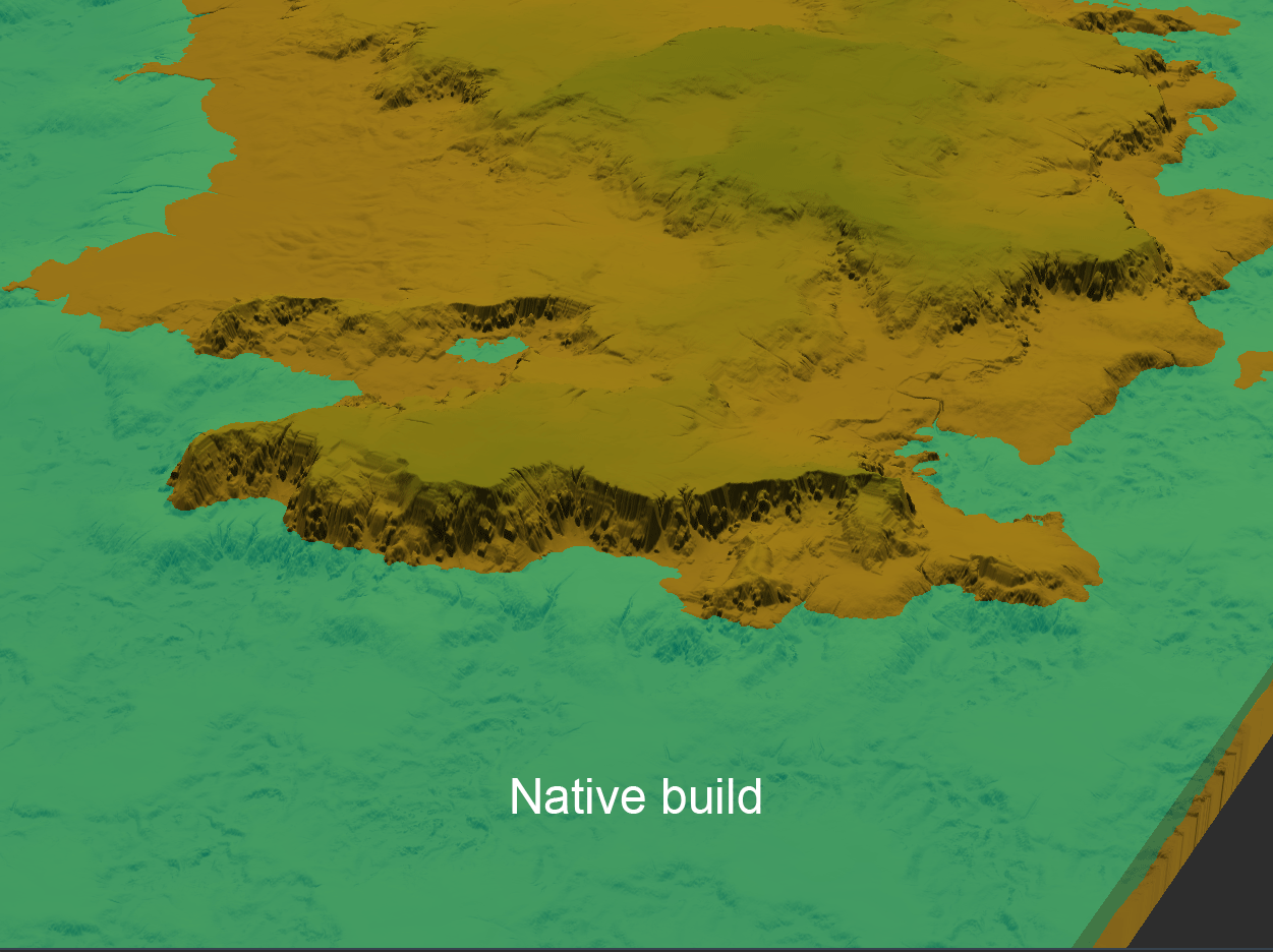
The issue is that it behaves differently depending on if the landmass is close to the extent border or not. In the second gif I posted you can see that in the native build (no immediate extent border) the cliff just transitions into the water but when I do a tiled build I suddenly have landmass there (immediate extent border) and the overall terrain looks way different even though I haven’t changed anything except the build method (regular build vs tiled build). Working with mask can mitigate the issue that’s true but I don’t like that you get different results based on how close to the extent border you are/which extent size you use even though the m/px ratio is the same which makes the results very unpredictable
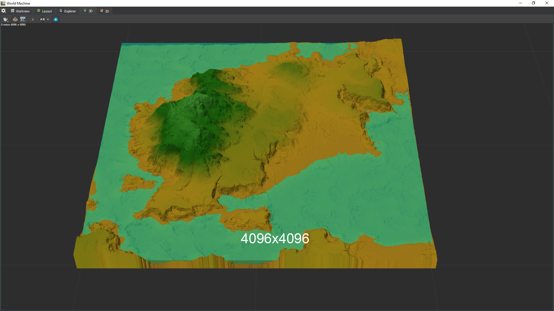
I found the cause of this to be the render resolution, though I don’t know what fixed it, it may be the +1 which rounds numbers like 1024 to 1025 or it may happen if you don’t use power of two numbers as render resolutions
Oh yeah good find! I tried it out and indeed the problem doesn’t seem to appear as heavily when using power of two plus one.
It can be heavily mitigated by either using the power of two plus one setting or using resolution override with custom resolution for the nodes, even though there are still differences happening between the different settings but not as big anymore.
As this is good to know and provides a workaround of course only the resolution override is a workaround for people (me included) in need of power of two maps and means I would need to change the resolution override everytime I change my rendering resolution which is very tedious. This could be mitigated by adding the option in the resolution override for n+1. But maybe this insight can shed light on why this problem appears and a possible fix.
Another workaround is using the same erosion again without geo time-enhance and averaging between the two but this adds much more rendering overhead.