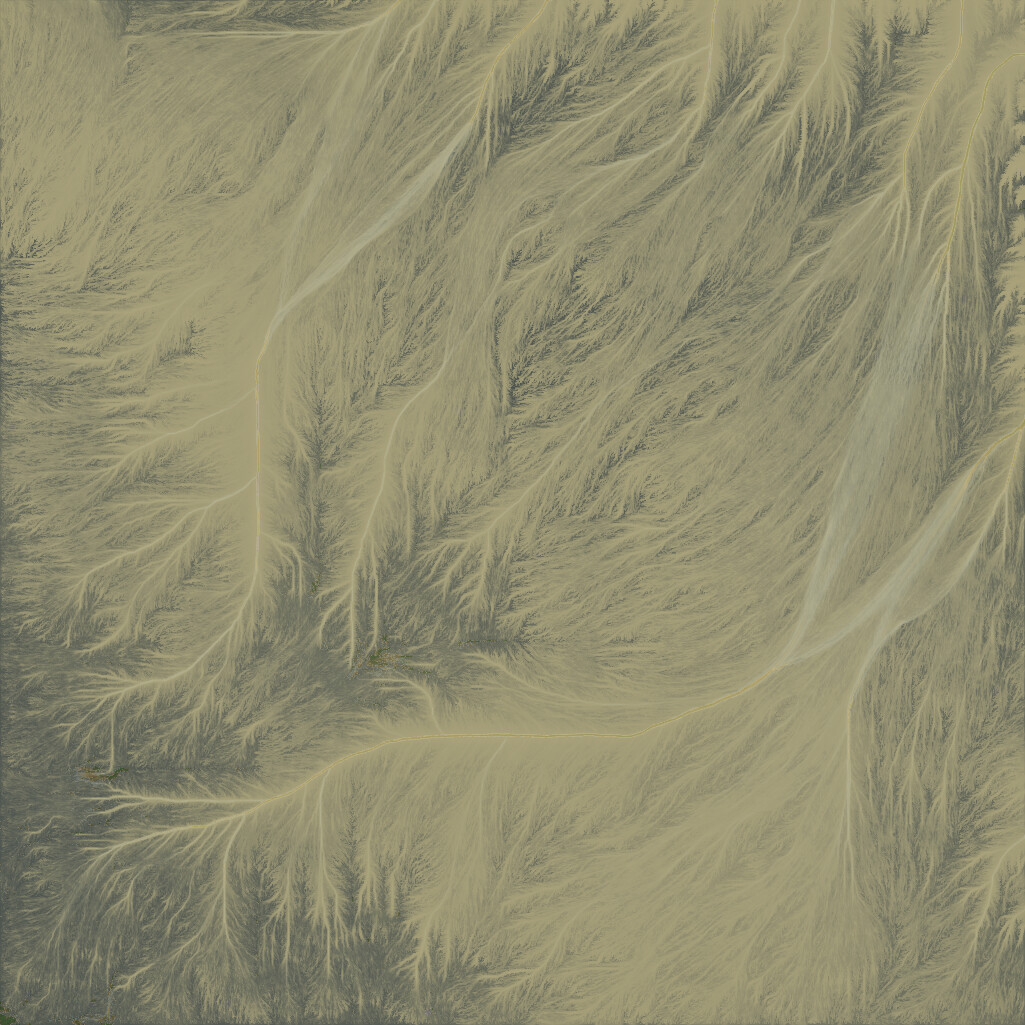
Hello, everyone. Id like to make a small terrain, about 100x100 meters, but heightmap looks too bad, it doesnt have any details compare to color map no matter of resolution I chose.

I need to see the TMD project file for more detail, but here’s my two cents based on those images.
-
Jpeg format is not the one you want to use for your heightmap. Use “height output”, and set the heightmap to TIFF 16Bit or higher. JPEG compression is designed for color images for the web, it’s only good for bringing in gradient colortables etc.
-
Your heightmap still has elevation, it’s just a bit low quality. Part of it is due to the reason I mentioned in #1, the other part may be a custom resolution set within your node graph. Double check everything, make sure none of your groups (if any) have “custom resolution” or similar setting enabled.
If these don’t help, PM me your wm project. I’ll see what I can do.
@WFab, thank you for replying. I tried different output formats for height map, including TIFF - same result. As for “custom resolution” I cant say I found something like this in the nodes. I took a starting project and changed only world dimensions. Cant figure out how to send private message so I attached project here
New Project.tmd (149.7 KB)
In your project settings, set your project origin to 50mx50m. It needs to be at the center of your terrain.
I’m building it high resolution after correction, to see if that fixes it. Will report later when I have some free time.
Here’s your fixed project. Should build properly this time.
New Project (fixed).tmd (149.7 KB)
Screenshot from viewport:
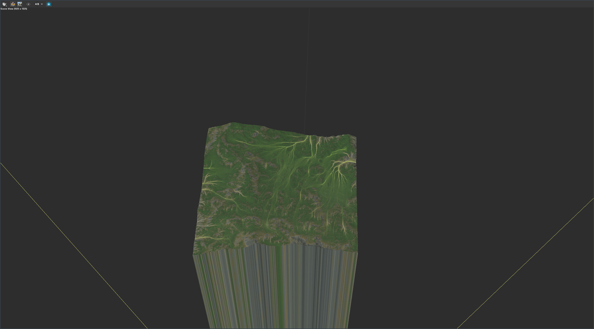
Well, height map still looks like this

Only thing I can do so far it’s apply Auto Tone in Photoshop to my height map. I created a landscape in Unreal Engine with it and it looks pretty the same
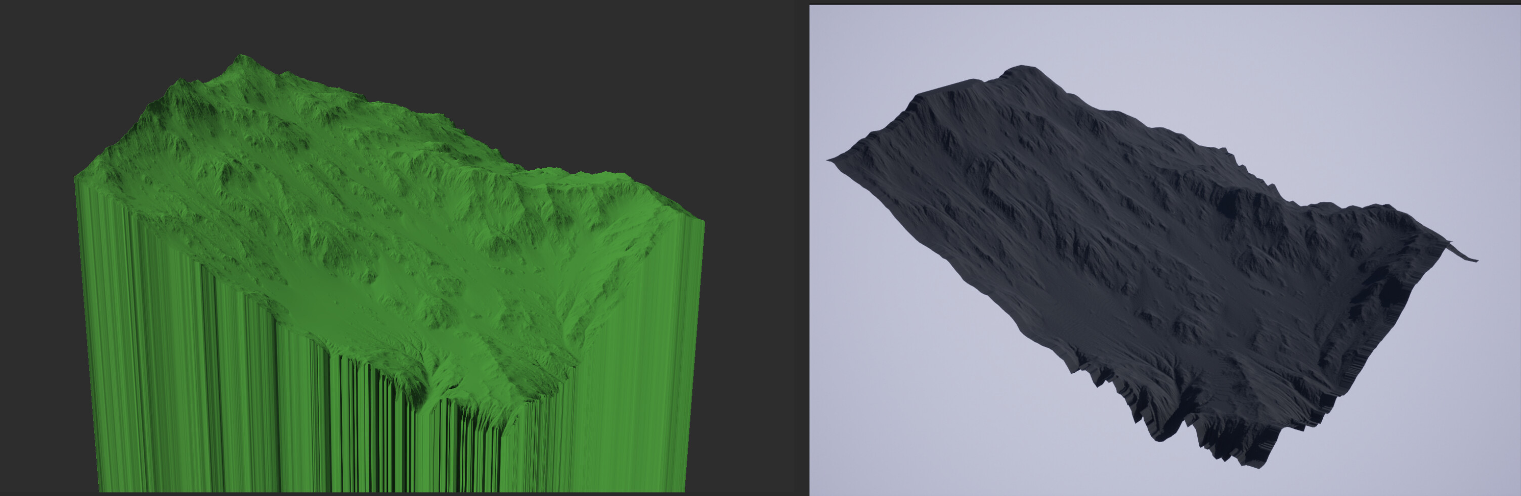
The reason there’s so little brightness range, is because of your scale. It’s too small. In world machine, all scale is relative. There are nodes in world machine to fine tune it, but photoshop works too. It works now, right? Not exactly clear from your reply. Looks fine to me.
Here it is with some height cut off. It’ll still look flat in 2D, but should work properly as a displacement map regardless. I just subtracted 970m of wasted height from your terrain.
New Project (fixed) V2.tmd (154.7 KB)
Yeah, in that case I will use Photoshop, no problem. Thank you very much for your help and your time.
1 Like
To fix this issue you can do either of two:
- Change the scale of the world to match the min-max elevation of your world. This is the preferred method, as you will allow for more “height” data to be available at each step in the process.
- Alternatively, you can use the
Clampdevice before exporting and set it toNormalise, this will ensure your heightmap will go from 0 to 1.
If you want more info on the topic, let me know, and I can reply with a more elaborate post.
That is just what I was looking for! “Project elevation quick scale” in the Project Settings, I finally figured how it should work. Thak you very much!
1 Like