Hello, is it possible to import both landcover data and elevation data? I am trying to base my project on realistic data.
Thanks
Hello, is it possible to import both landcover data and elevation data? I am trying to base my project on realistic data.
Thanks
Hi Brandon,
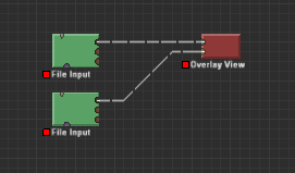
Definitely! Use several File Input devices. For texture data, make sure you set the file input device to “Interpret as RGB”
You can then view the land cover overlaid atop the terrain data with an Overlay view device:
This topic was automatically closed 90 days after the last reply. New replies are no longer allowed.