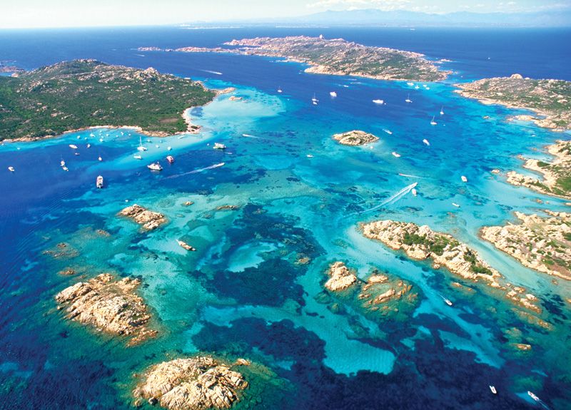
currently I am working on an island landscape and I am trying to create an interesting underwater landscape. I am aiming to create something like this:
I know it’s basically a combination of different noises and materials (rock, sand, corals/vegetation) but what I am struggling with is a) finding a good starting point and b) setting the context. Of course I can just combine these noises but what underwater landscapes always have is a context to the islands so there is a certain flow and direction around those islands. Maybe you can give me some tips? Thanks
It’s a complex problem, dealing with drastically different type of terrains in a monolithic fashion, so that everything flows naturally. There are ways to do it convincingly, but requires certain considerations. Again, planning in advance will save you a lot of time in the end.
If you’re using “coastal erosion”, do it first before any other kind of erosion. This way you have a clear water line to work with in later steps, along with a water mask. You can go the quick route, use “underwater smoothing” for a cool diffuse look underwater. Then you can do the rest in the material. Generally, underwater rocks are either smoothed, or very craggy. Sometimes there’s lateral erosion due to currents, but it’s rare.
If you don’t like automatic smoothing, disable it. Use strata and blur to fake that lateral erosion instead automatic smoothing, or use transform displacement in the noise to stretch it in a convincing fashion, then blur. Water mask from coastal erosion is your friend all the way.
Think of the island as a single landmass, that exists in two drastically different kind of erosive environments. Rest of your planning should revolve around this concept. Create your landmass from the first shape keeping this concept in mind.
Especially from a geological standpoint, this is probably the most important thing to remember. The islands are not individual pieces of land, separated by water, they are a single landform that is partially covered in water. Dry terrain informs underwater terrain informs dry terrain.
Also a key thing to remember is that you can still use the water mask output of the coastal erosion device, even if you don’t use the terrain results themselves, if you’re finding that coastal erosion is changing your terrain too much.
Another useful trick is to use the Snow device to create sand depositions underwater. And again, to stress what blattacker said, we’re talking about one landmass here, simply with one part underwater, and the other part above. To give you yet another “guide”, here are the steps I use:
Create a bedrock layer.
Create a bulge/spot with increased height, this will be your island.
Use the Coast Erosion device to create a distinct separation between underwater terrain and land.
From that point on, use the Water Mask to separate/filter the effects you apply to your land terrain. Keep in mind that certain effects can cause the terrain land inwards to get below the sealevel. That doesn’t need to be an issue, but it can become one if your beaches get lowered too much, and you don’t “retexture” it.
You can use the Water Depth Map to determine where you want to place certain types of water vegetation and such.
just wanted to give quick feedback on how it’s going. Unfortunately I cannot show you results because I am working on an unannounced project but your tips definitely helped! Also what I found worked quite well was using the crystallize node together with a distortion generator because it can generate a nice noise with patterns that resemble little underwater islands of rocks or patches of coral/vegetation. Thanks again for your help